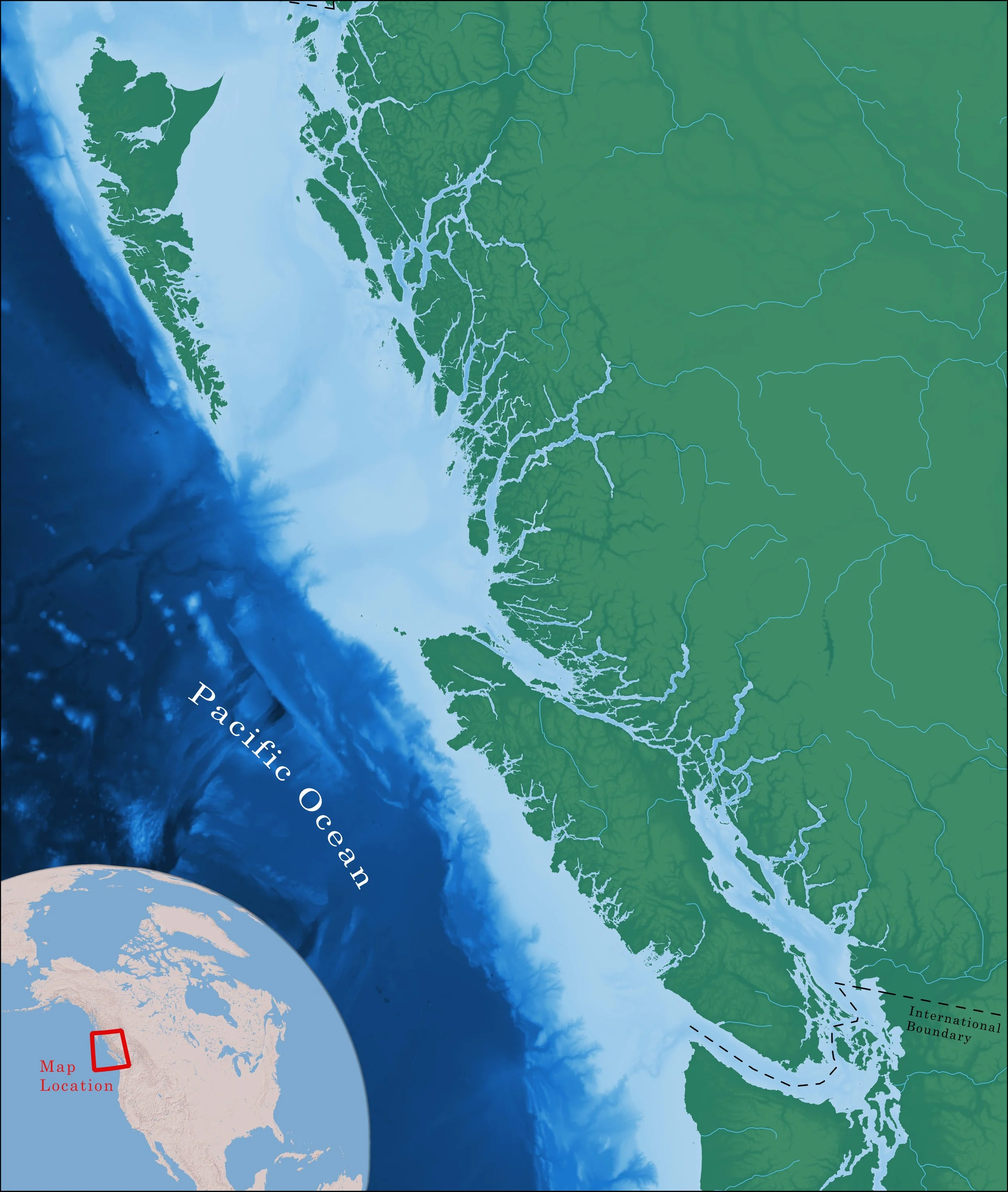
British Columbia
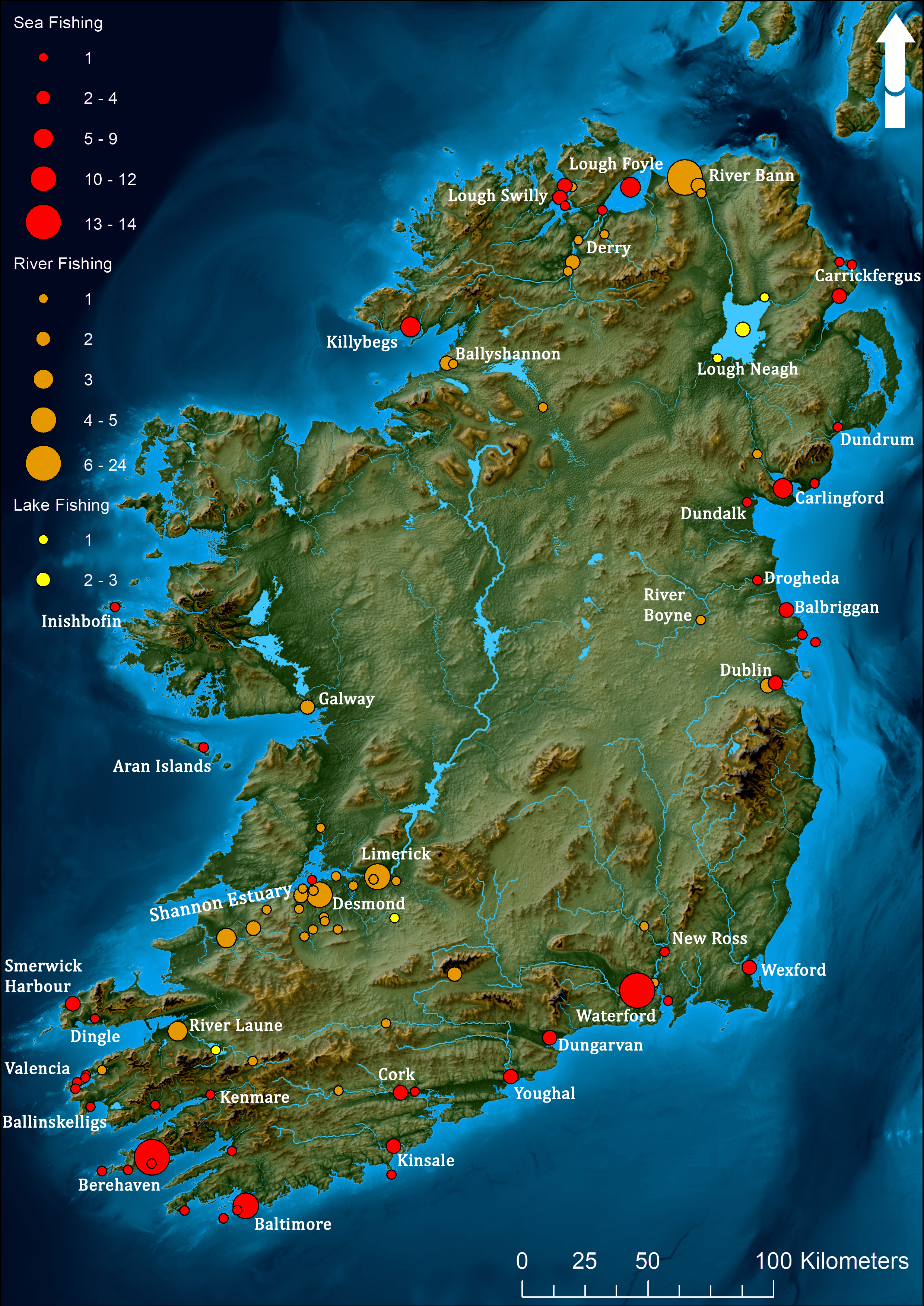
Count of Fishing Locations in Ireland, 1496-1603
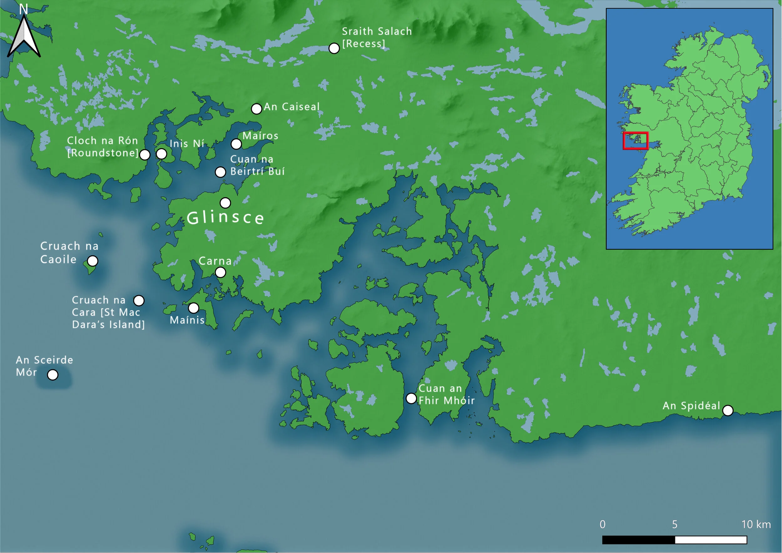
National Folklore Foundation Map
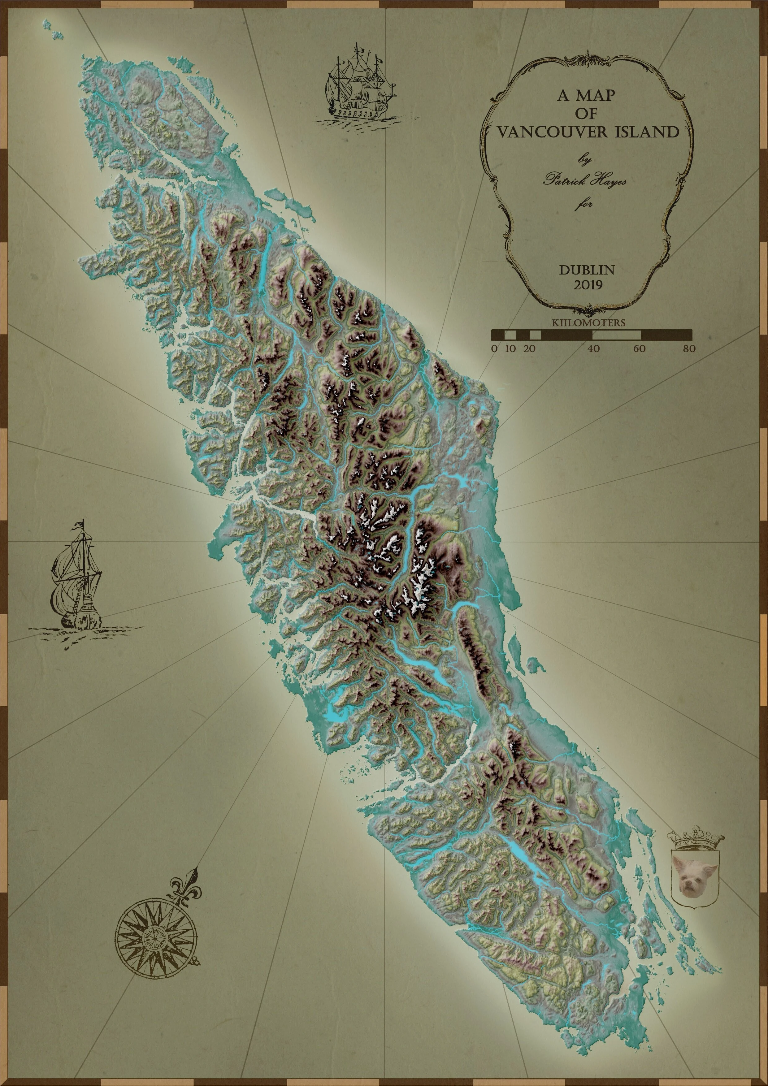
Map of Vancouver Island

Tentative Indication of Cod Fishery Locations, 1520-1790
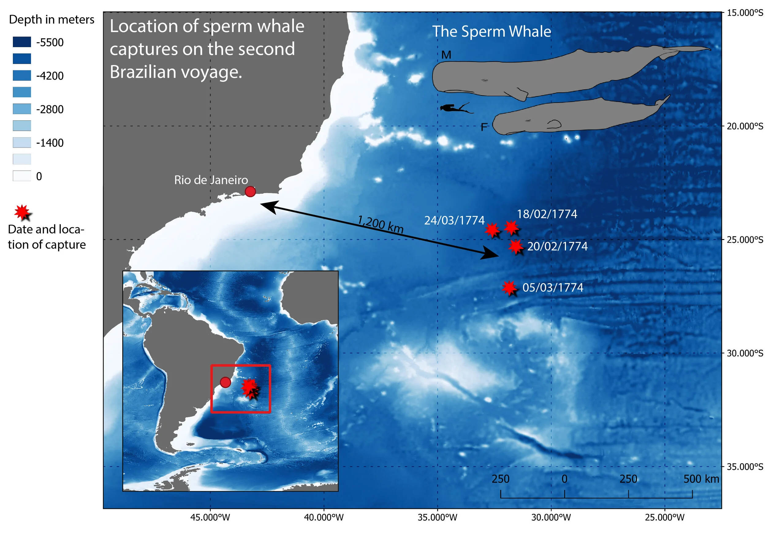
Sperm Whale Captures 18th Century Brazil
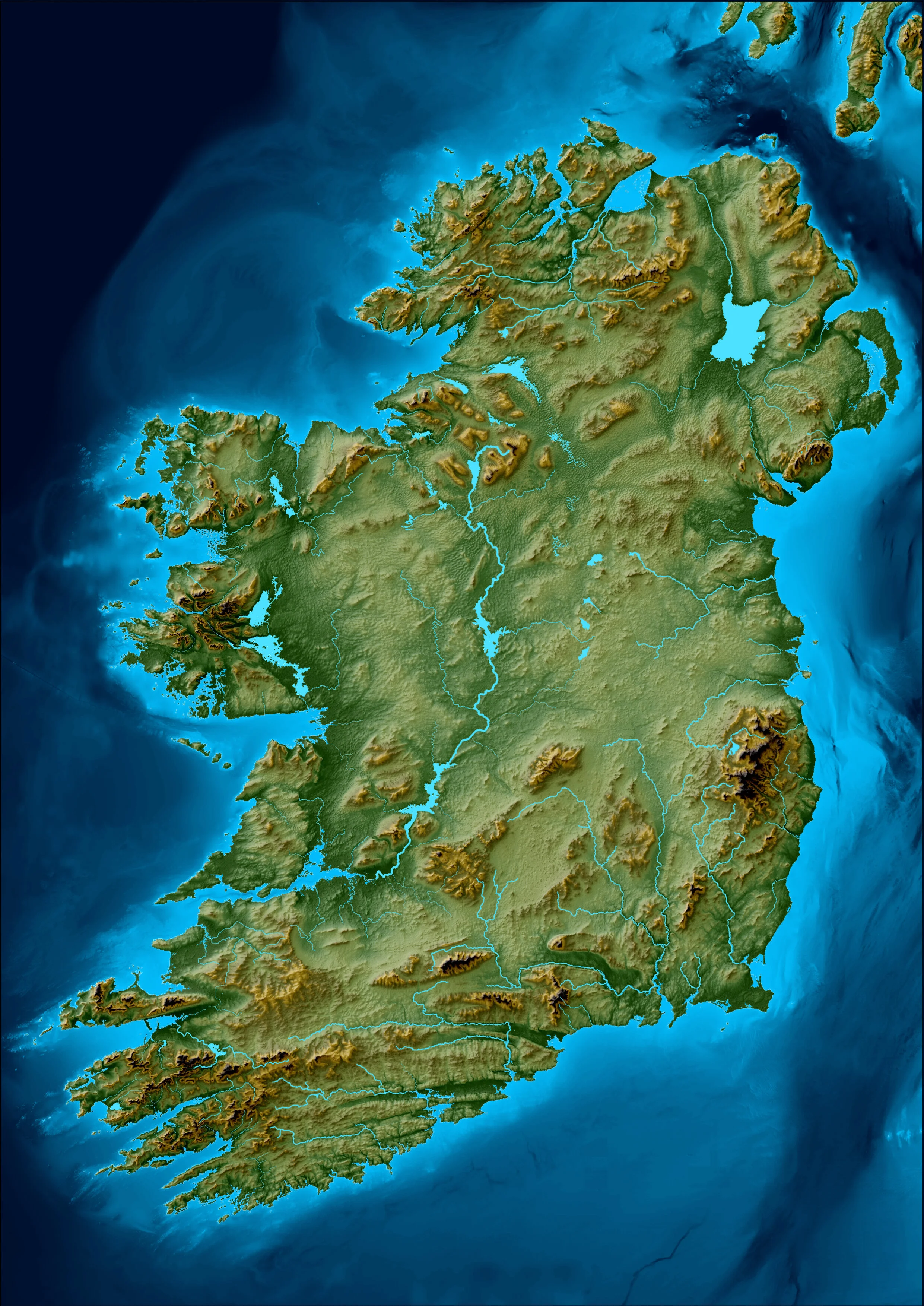
Shaded Relief Map of Ireland
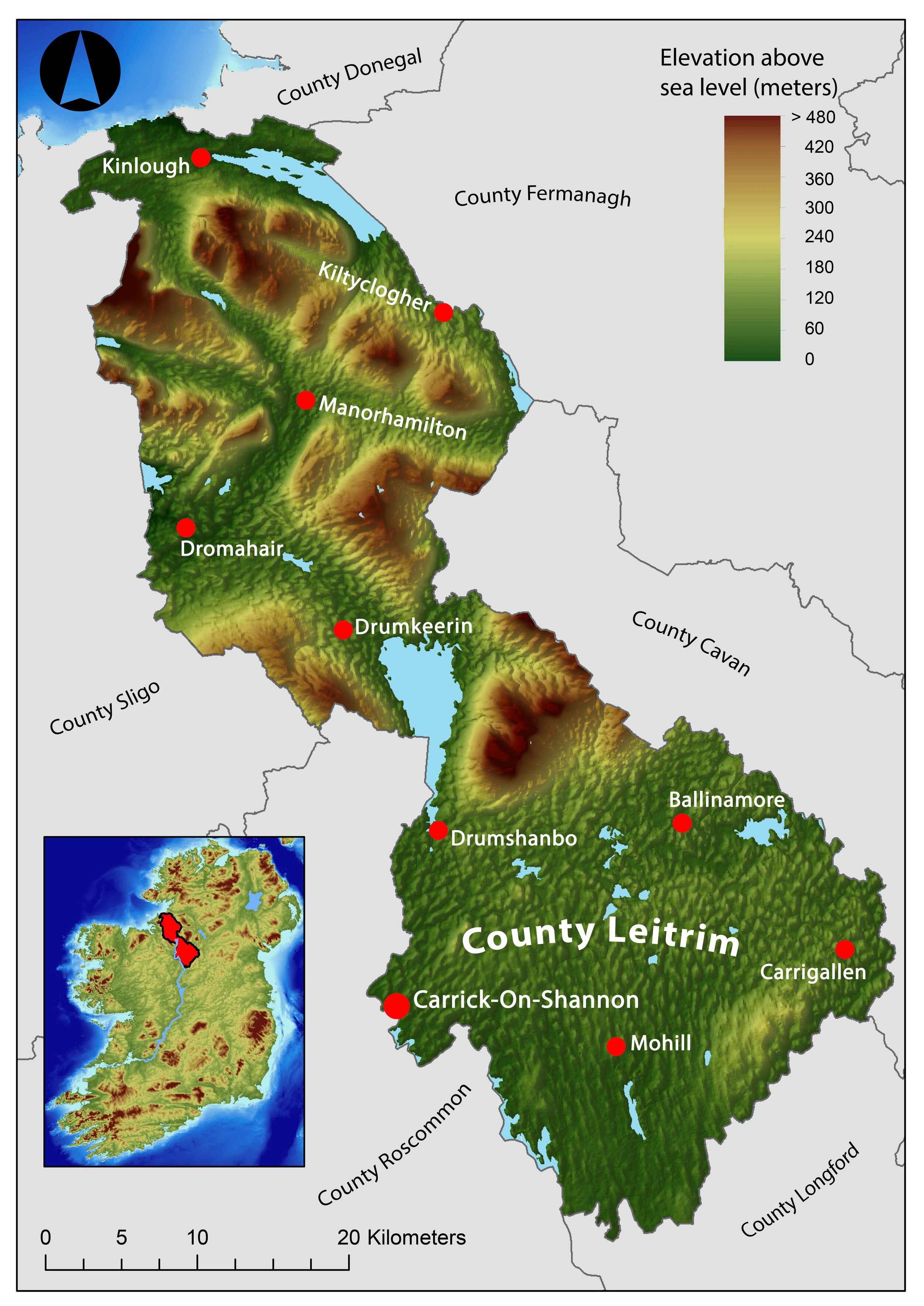
Leitrim: History and Society back cover map
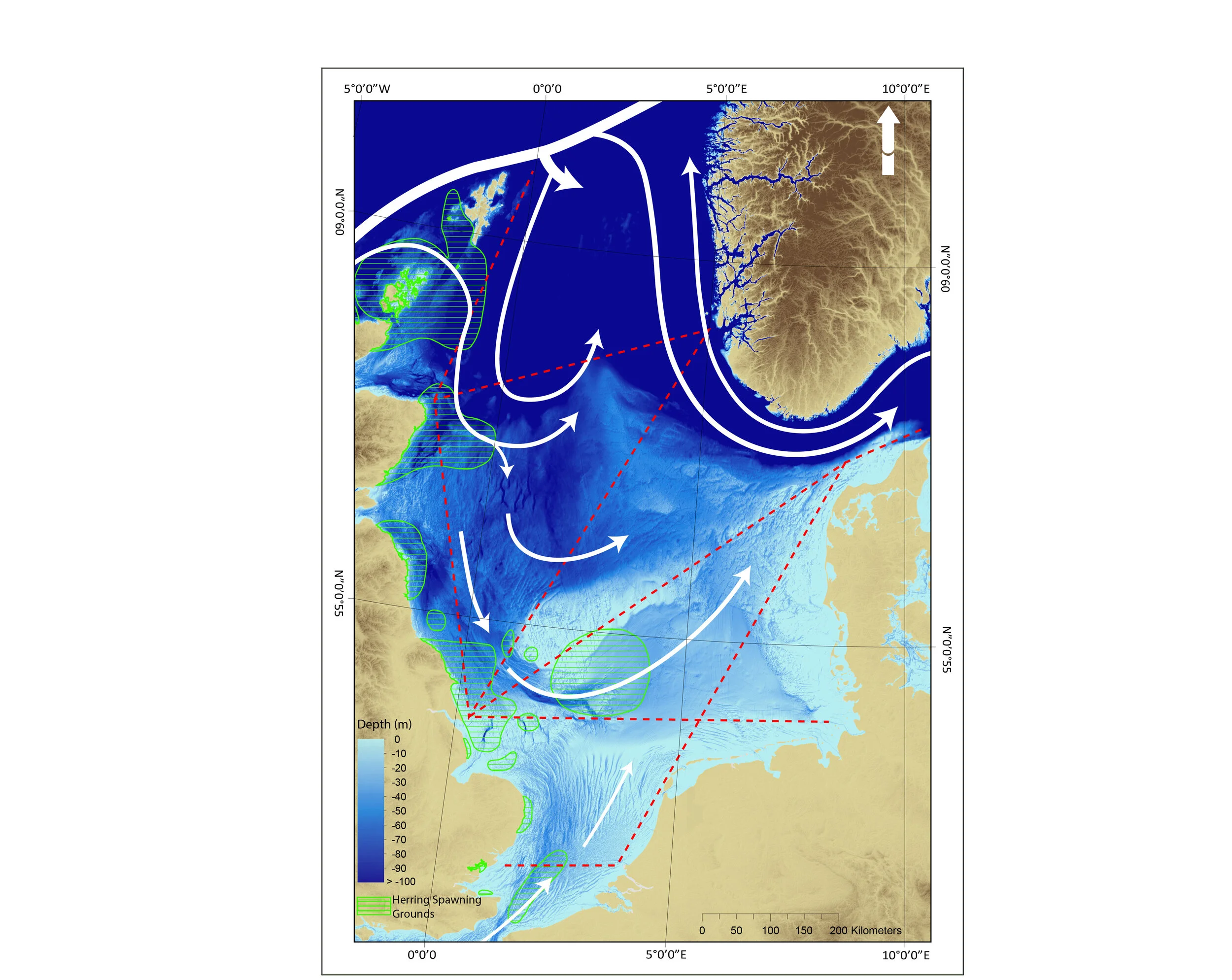
Ocean Currents of the North Sea
British ColumbiaMap of British Columbia, Canada
Count of Fishing Locations in Ireland, 1496-1603 A map from my PhD thesis showing how many times different fishing locations were mentioned in archival sources.
National Folklore Foundation MapA map of western Galway for the National Folklore Foundation of Ireland.
Map of Vancouver IslandA beautiful map of Vancouver Island with shaded relief and eighteenth century map elements.
Tentative Indication of Cod Fishery Locations, 1520-1790A map from the paper Accelerated extractions of North Atlantic cod and herring, 1520–1790.
Sperm Whale Captures 18th Century Brazil A map showing the location of sperm whale captures from the second ever Brazilian sperm whale hunt in 18th Century Brazil. The map will be published in an upcoming paper in Arcadia Environmental History (http://www.environmentandsociety.org/arcadia).
Shaded Relief Map of IrelandA shaded relief map made from bathymetry and digital elevation model data. The map will feature in my PhD thesis on the environmental history of Ireland’s sea fisheries.
Leitrim: History and Society back cover mapA map of country Leitrim made for the back cover of Leitrim: History & Society (http://www.geographypublications.com/product/leitrim-history-society/)
Ocean Currents of the North SeaA map showing ocean currents, herring spawning grounds and the routes taken by vessels for the continuous plankton recorded. Made for an upcoming publication about ocean productivity in the North Sea.
info
/
2
3
4
5
6
7
8
9
·
·
·
·
·
·
·
·